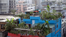


Flooding is inseparable from Bangladesh’s identity. For centuries, the country has been shaped by rivers as monsoon water spread across floodplains, replenished wetlands, and drained through a vast network of rivers, canals, beels, and haors. However, while floods are natural, the growing destruction they cause is not. Climate variability is making floods harder to anticipate, but climate alone cannot explain why water increasingly becomes trapped around homes, roads, and farmland. Over the years, people have occupied floodplains, filled wetlands, blocked canals, and built roads and embankments across natural flow paths. We are steadily removing the places where floodwater once went.
Research by the University of Texas at Arlington found that nearly 600,000 square kilometres of natural floodplains were converted to agricultural and urban land worldwide between 1992 and 2019—an area about four times the size of Bangladesh. When a floodplain is filled or disconnected from a river through unplanned development, its storage capacity does not disappear without consequences: water rises higher upstream, moves faster through narrow openings, remains trapped longer, or is redirected towards communities that were previously less exposed.
The country now needs a two-part strategy: i) protect and restore its floodplains, canal networks, and native haor wetlands; and ii) build a new generation of impact-based early warning system using AI, hydrological models, and local observations blended with the latest satellite data. One cannot succeed without the other.